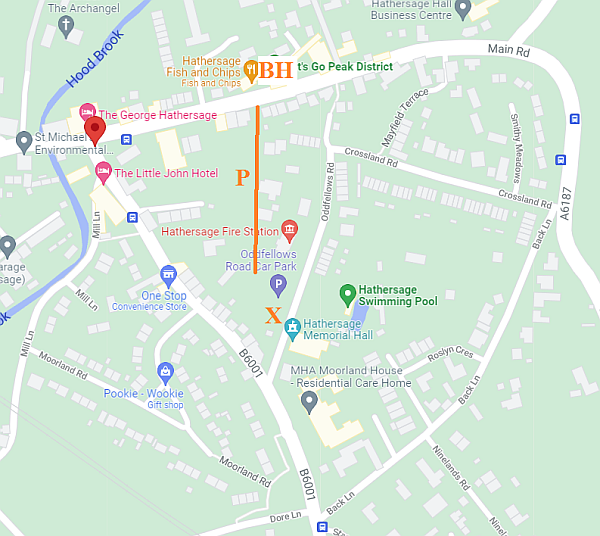
Start Location: the main car-park in Hathersage (orange X on the map) Latitude/Longitude: 53.329 -1.654 SK231814
Directions:
Parking: The car park is exorbitant and parking on the main roads is for 40 minutes only. There may be the odd space on Oddfellows Road, Crossland Road, Moorland Road and in particular along the station approach or Dore Lane very bottom of map.
Meet at: 09.45 for 10.00 start (we can pre order our lunch).
Distance: 4 miles but we may take a look at Carl Wark if there’s time.
Climb:
Description:
Lunch: outside at the Bank House (BH on map) at 1pm. Note there is a footpath (orange P) from the far corner of the car park past the Fire Station and Methodist Church to the main road across from Bank House.
Route: We will walk to Leadmill Bridge, and along the river Derwent to Harper Lees. We will ascend to Greenwood Farm and and along to some millstones where we’ll have an early coffee break. We’ll strike uphill across the road and under Millstone Edge to Hathersage Moor then back via Mitchell Field and Hathersage Church to the Main Road.
Short cuts: From Harper Lees the alternative just continues along the river towards Grindleford
Difficulties:
Other:
Leader(s): Phil Barry standing in for Ian who is recovering from Covid